From the NewsXR Weather Center: Southern Tier 5-Day Forecast
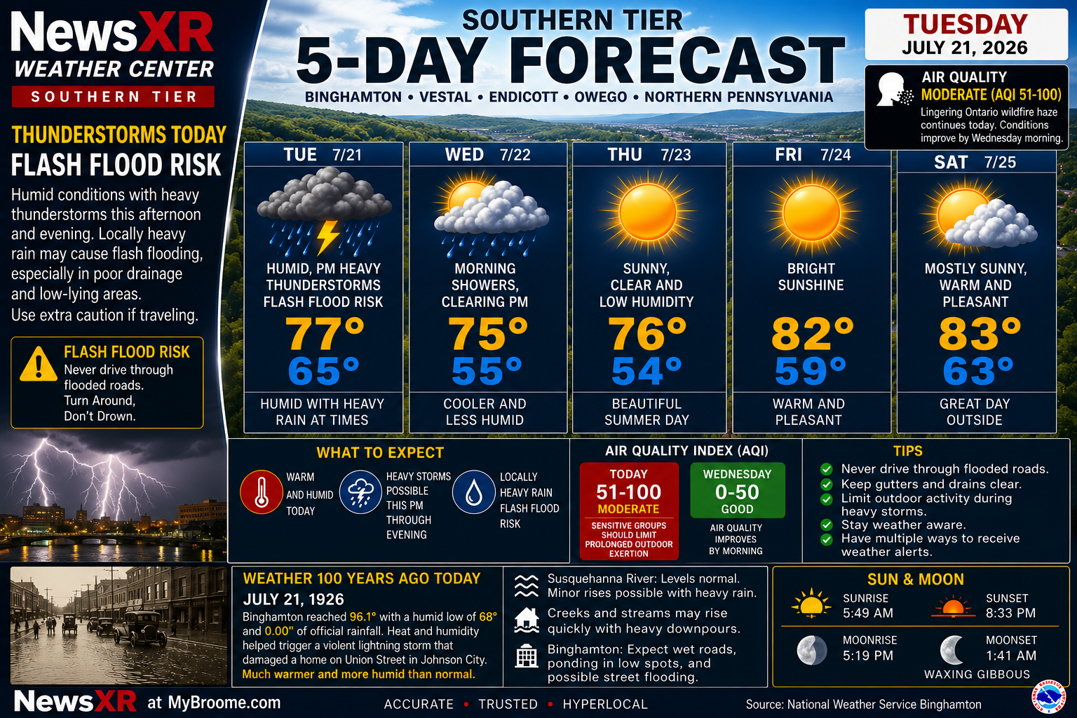
Binghamton and the Southern Tier are facing an active weather day, with humid air, heavy thunderstorms and localized flash-flood risk moving through the region. Damaging winds are also possible as storms push across the area before a cooler and more comfortable midweek pattern arrives.
Air quality is improving, but wildfire smoke from Ontario continues to leave a light haze across parts of the region. The local AQI is in the moderate range, much better than last week’s unhealthy levels, but sensitive groups should still use caution during periods of visible haze. Today’s storms and shifting winds should help scrub the air and bring clearer conditions by Wednesday morning.
The 5-day forecast brings a stormy Tuesday, morning showers and clearing Wednesday, then a beautiful stretch of sunshine and lower humidity Thursday into Saturday.
Today’s Weather 100 Years Ago Today feature looks back to July 21, 1926, when Broome County was in a sweltering midsummer heat wave. Binghamton reached 96.1 degrees, with a humid overnight low of 68 and no official rainfall recorded. That heat helped fuel volatile conditions, including the lightning storm that damaged a Johnson City home on Union Street that night.
FOR OUR YOUNGER NEWS CONSUMERS SEE THE COVER PHOTO NEWS FLASH.
👉 Drop your comments below.
© 2026 CompanyXR Media Group – All Rights Reserved
Leave a Reply